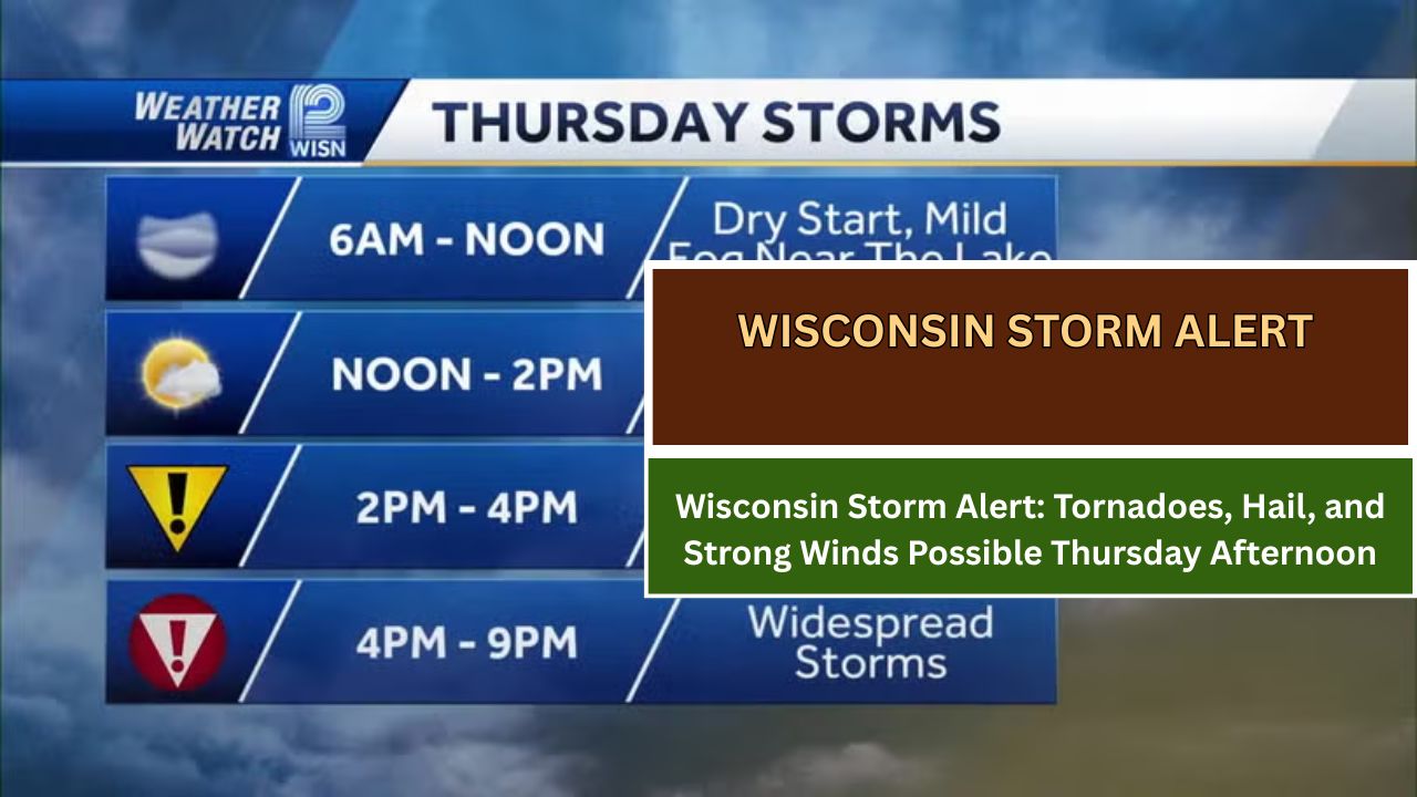
MILWAUKEE, WI — A round of strong to severe storms is expected to sweep through southern Wisconsin on Thursday, May 15, with threats including tornadoes, large hail, and damaging wind gusts, according to the National Weather Service (NWS) in Milwaukee/Sullivan.
When and Where
The greatest threat window is between 2 p.m. and 10 p.m. Thursday, affecting areas across southern and southeastern Wisconsin, including Milwaukee, Madison, and nearby counties.
All forms of severe weather hazards are possible during this period. However, uncertainty remains around the intensity, timing, and coverage of the storms.
What to Expect
Forecasters are tracking developing weather systems that may bring:
- Heavy rainfall
- Wind gusts exceeding 60 mph
- Large hail
- Isolated tornadoes
The NWS warns that conditions could rapidly evolve, making it critical for residents to stay alert throughout the afternoon and evening.
Be Prepared
Officials urge residents to:
- Review shelter plans in advance
- Stay weather-aware during the day
- Keep multiple alert sources, such as NOAA Weather Radio, mobile apps, or local broadcasts, handy
“Be ready to act quickly if warnings are issued,” NOAA officials emphasized.
May typically marks the start of an active severe weather season in Wisconsin, and Thursday’s system could bring significant hazards, particularly during peak commuting hours.
Stay Informed
For the latest updates, continue to monitor:
- Local TV and radio weather forecasts
- National Weather Service – Milwaukee/Sullivan
- Official social media alerts
This article has been carefully fact-checked by our editorial team to ensure accuracy and eliminate any misleading information. We are committed to maintaining the highest standards of integrity in our content.

Outside of work, he enjoys playing chess, following cricket, and writing short stories. His commitment to integrity and in-depth analysis strengthens OTE News’ mission of providing trustworthy journalism.