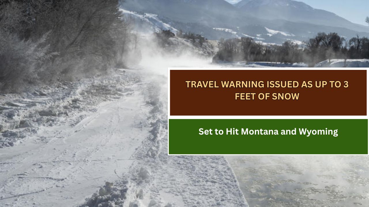
The National Weather Service (NWS) has issued winter storm warnings and advisories for parts of Montana and Wyoming, as a major snowstorm threatens to dump up to 3 feet of snow in mountainous regions by Wednesday night—posing significant travel hazards and elevating avalanche risksWhy It Matters
The NWS is warning of serious disruptions to travel and dangerous backcountry conditions as the storm brings heavy snowfall and strong winds to the Absaroka/Beartooth Mountains, Crazy Mountains, and other high-altitude areas.
Avalanche risk is expected to rise sharply following periods of intense snowfall, particularly on north-facing slopes. The winter storm warning remains active through midnight Wednesday.
What to Know
A winter storm warning is issued when a significant combination of hazardous winter weather is occurring or expected.
According to the NWS office in Billings, Montana, the region can expect:
- 1 to 3 feet of snow above 7,000 feet elevation
- Winds up to 30 mph
- Limited visibility and hazardous travel
- Impacts to snow removal operations on the Beartooth Highway
- Dangerous conditions for recreation and backcountry travel
“If you must travel, keep an extra flashlight, food, and water in your vehicle in case of an emergency,” the agency advised.
In northern Wyoming, a winter weather advisory is also in effect.
The NWS office in Riverton forecasts:
- Up to 12 inches of snow in the Absaroka Mountains
- As much as 20 inches on higher peaks near Highway 14
- Gusty winds and whiteout conditions in the Bighorn Mountains
Drivers are being urged to slow down and use caution, especially in backcountry areas.
What People Are Saying
On Tuesday, the NWS in Billings posted on X (formerly Twitter):
“Widespread [precipitation] begins today. Lower elevations will see rain and mountains above 7,000 feet will see heavy snow… Isolated thunderstorms possible in the afternoon/evening with one or two possibly becoming severe near the Dakota border tonight.”
Jason Stiff, meteorologist at KTVQ, added:
“Rain, mountain snow and thunderstorms will push from south to north over Wyoming and Montana this evening, overnight and early Wednesday… Heavier rain will hit the Billings area between 11 p.m. and 2 a.m., peaking around midnight. Be safe!”
What Happens Next
At the time of writing:
- The winter storm warning is in effect until midnight Wednesday
- The winter weather advisory remains active through 6 a.m. Friday
The National Weather Service continues to issue real-time updates via its official website.
This article has been carefully fact-checked by our editorial team to ensure accuracy and eliminate any misleading information. We are committed to maintaining the highest standards of integrity in our content.

Outside of work, he enjoys playing chess, following cricket, and writing short stories. His commitment to integrity and in-depth analysis strengthens OTE News’ mission of providing trustworthy journalism.